sonar mapping
sonar mapping on World Data Ocean: a running collection of 12 stories we have gathered and hand-picked because they are worth your time. Every post here touches on sonar mapping in some way — the news, the analysis, the deep dives, and the occasional surprise find. A Global Hub for Ocean Intelligence 4 World Data Ocean is a centralized digital platform where researchers, scientists, and ocean enthusiasts converge to explore, analyze, and… New stories are added to this page as we find them, so check back if you want to keep up with what is happening around sonar mapping, or subscribe to the RSS feed to get them as soon as they are published. Browse the collection below, or head back to the homepage to see everything World Data Ocean is covering right now.

Performance evaluation of YOLO models for target detection from ocean sidescan sonar imagery
Sidescan sonar imagery presents unique challenges for target detection, characterized by seabed clutter, low contrast, and frequently missed small targets. This study comparatively evaluates six YOLO models—YOLOv4, YOLOv6, YOLOv7, YOLOv9, YOLOv13n, and YOLO26n—across two distinct datasets (D1 and D2), utilizing metrics like mAP and FPS. Findings reveal a trade-off between model size and generalization, with lightweight models demonstrating superior noise resilience. Notably, YOLO26n achieves exceptional speed (526.32 FPS) and suitability for deployment on low-computing devices, as explored further in our Ocean Data
First evidence of live mesophotic coral reefs on the Benin continental shelf
Recent marine surveys off the coast of Benin have yielded the first confirmed visual evidence of living mesophotic coral ecosystems (MCEs) within the Gulf of Guinea—a region previously presumed devoid of such habitats. Utilizing side-scan sonar and underwater video, researchers documented thriving octocoral communities at depths of 54 meters, forming a unique mesophotic coral garden. This discovery, spanning approximately 7 kilometers, significantly expands our understanding of West African marine biodiversity and underscores the urgent need for further exploration and baseline data collection.
Seafloor morphology and sedimentology in the Brazilian semi-arid continental shelf: a high-resolution geophysical baseline from the Ceará Basin
High-resolution geophysical surveys are critical for understanding and protecting coastal regions. This study establishes a detailed baseline of seafloor morphology and sedimentology within the Brazilian semi-arid continental shelf's Ceará Basin, covering over 12 km². Integrating multibeam echosounder data, side-scan sonar, and sediment sampling reveals contrasting seabed features – from channel systems and circular depressions to extensive sand-wave fields – demonstrating the interplay of inherited shelf morphology and hydrodynamic processes.
Seafloor imagery with an advanced imaging sonar system
Advanced seafloor imaging is undergoing a significant evolution through multireceiver synthetic aperture sonar (SAS), enabling enhanced mapping resolution. While SAS performance is constrained by strict parameter requirements to ensure uniform signal sampling, our research addresses a critical limitation: receiver redundancy that can impede image reconstruction. Employing an innovative approach, we identify and compensate for range approximation errors, ultimately achieving high-quality images—even when traditional matrix inversion methods fail.

WWII “Hell Ship” Sunk By US Torpedoes After Misidentification, Found Off Philippines After 80-Year Search
Following an 80-year search, the wreckage of the *SS Quanza*, a WWII "Hell Ship" tragically lost in 1944, has been located off the Philippines. The vessel, carrying British and Dutch servicemen as prisoners of war, was mistakenly sunk by a US Navy torpedo. This discovery provides a validated final resting place for hundreds of individuals, offering empirical closure to a poignant chapter of maritime history. Further insights into Pacific mapping efforts supporting such discoveries can be found in "Camera 1: 2026 Pacific Islands Mapping (EX2604)."

Indian Navy Set To Commission Three Warships As China Expands Indian Ocean Presence
The Indian Navy is poised to significantly bolster its maritime capabilities with the imminent commissioning of three frontline warships, marking a rare event – only the second such instance in recent years. This strategic move underscores India's response to China's expanding presence in the Indian Ocean. These new platforms represent a validated investment in national security and ocean intelligence, supporting calibrated naval operations.
Any advice on how to get into public policy regarding oceans?
Embarking on a career in public policy related to ocean conservation is a commendable goal, especially for someone with a strong foundation in Ocean Science. Your summer experience in seabed mapping, combined with your writing skills and involvement in policy-planning clubs, will serve you well. Consider seeking internships with governmental agencies or NGOs focused on marine policy, and leverage your STEM background to enrich discussions on policy impacts.
Any advice on how to get into public policy regarding oceans?
As a first-year Ocean Science student eager to transition into public policy related to marine conservation, you are well-positioned to make a significant impact. Your background in STEM skills, coupled with strong writing abilities and prior involvement in policy-planning clubs, provides a solid foundation. Consider leveraging your summer experience in seabed mapping to connect technical knowledge with policy discussions.

China Is Building A Great Wall Of Undersea Sensors To Track U.S Nuclear Submarines In Indo-Pacific
China is developing an extensive network of undersea sensors in the Pacific Ocean aimed at tracking U.S. Navy nuclear submarines, strengthening its sea-based nuclear deterrent. This initiative underscores the growing strategic competition in the Indo-Pacific region as nations enhance their maritime capabilities. The deployment of these sensors reflects a commitment to advanced maritime surveillance technologies. For further insights into the evolving landscape of naval technology, explore our article on Hanwha Ocean's discussions with Microsoft and Google regarding future AI warships.

U.S Firm Reveals New MANTIS UUV That Can Detect Mines, Conduct Surveys & Map The Seabed
A U.S. firm has unveiled the MANTIS Unmanned Underwater Vehicle (UUV), a cutting-edge technology designed to detect naval mines, conduct search and recovery missions, and perform detailed underwater mapping and offshore inspections. This innovative UUV enhances operational capabilities in maritime safety and environmental monitoring. As the demand for advanced ocean intelligence rises, the MANTIS represents a significant advancement in underwater exploration. For further insights into maritime operations, read our related article, "China Fines CMA CGM, MSC And Hapag-Lloyd Over Freight-Rate Violations At Major Ports."

Thales Launches AI-Powered Mine Warfare System To Secure Global Sea Lanes
Thales has unveiled the Expeditionary PathMaster, an AI-powered mine warfare system designed to enhance the security of global sea lanes. Originally developed for the Marine Nationale, this innovative solution offers scalability and interoperability, addressing the complexities of modern maritime threats. By leveraging advanced technology, Expeditionary PathMaster enhances situational awareness and operational effectiveness, ensuring a proactive approach to maritime safety. This launch underscores Thales' commitment to providing cutting-edge solutions that support global maritime security and foster collaborative defense efforts across nations.
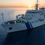
China’s Network Of Underwater Sensors In Indian & Pacific Oceans Could Neutralise U.S. Submarine Stealth
China's strategic expansion in the maritime domain is underscored by its extensive network of underwater sensors in the Indian and Pacific Oceans. This initiative aims to enhance the surveillance capabilities of its modern submarine fleet, which is among the largest globally. By deploying these advanced technologies, China seeks to neutralize the stealth advantages of U.S. submarines, thereby reshaping the balance of power in crucial maritime regions. This development highlights the growing importance of underwater intelligence in contemporary naval warfare and international security dynamics.